Wednesday, April 30, 2008
Geodesy
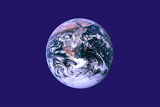
Geodesy is the science of determining the geometry, gravity field, and rotation of the Earth and their evolution in time. Traditionally, geodesy has been serving other sciences and have had many societal applications, including mapping. With the advent of satellite geodesy it developed into a science making unique contributions to the study of the Earth system, its inherit dynamics, and its response to climate change, as well as a tool underpinning a wide variety of other remote sensing techniques. Facilitated by the Global Navigation Satellite Systems such as GPS, a wide and growing set of applications associated with positioning and navigation is opening up.
Measure gravity with GOCE
Vanguard 1 - the first geodetic satellite
Atmospheric geodesy
GNSS - Galileo's second satellite Giove B
Very Long Baseline Interferometry - Fort Davis, Texas, US
GOCE
Mapping Mountains
Struve Geodetic Arc
New Orleans Subsidence
Astronomy

Here I will collect some highlights from my astronomy posts.

Venus
Hubble Anniversary
Phobos
Space Rocks
Mighty Mercury
Winter Soltice
Tuesday, April 29, 2008
Volcanoes and Climate Change

Credit: NASA/JPL
Huaynaputina, Peru erupted around 1600 and caused climate change
As long as I can remember I've heard theories about the effect of volcanoes; climate change, death of dinosaurs etc. It is clear to me that Mother Nature, the planet itself, is capable of creating huge changes. Natural hazards like volcanoes, earthquakes, tsunamis, land slides represent a real danger to large communities. It is also likely that climate can be altered by these vast physical events. We still need to better understand these phenomena as well as to what degree the increased number of humans also can change this planet...
Studies of ancient events are important input for our understanding of the Earth today.
In the case of the Peruvian volcano Huaynaputina in the 1600 it seems it resulted in a climate cooling.
Can't get enough of volcanoes? IntrepidDreamer made an outstanding collection on Earth Day.
Mayon Volcano
Taal Volcano
Mount Makiling
Mount Pinatubo
Labels:
earth observation,
natural hazards,
volcanoes
Polar Bear

Satellite image taken by Advanced Synthetic Aperture Radar (ASAR) on Envisat - a European Earth Observation Satellite. The berg - in the right of the picture - is located to the east of South Georgia in the southern Atlantic Ocean. ASAR can see through clouds, and can distinguish different types of ice.
I never stop being amazed by the power of modern technology. I have always thought that space observations are first and foremost useful, like in this case, but I appreciate that it can be used for destructive purposes also.
Earth Observation Ice

Satellite image taken by Advanced Synthetic Aperture Radar (ASAR) on Envisat - a European Earth Observation Satellite. The berg - in the right of the picture - is located to the east of South Georgia in the southern Atlantic Ocean. ASAR can see through clouds, and can distinguish different types of ice.
I never stop being amazed by the power of modern technology. I have always thought that space observations are first and foremost useful, like in this case, but I appreciate that it can be used for destructive purposes also.
Monday, April 28, 2008
The Sun

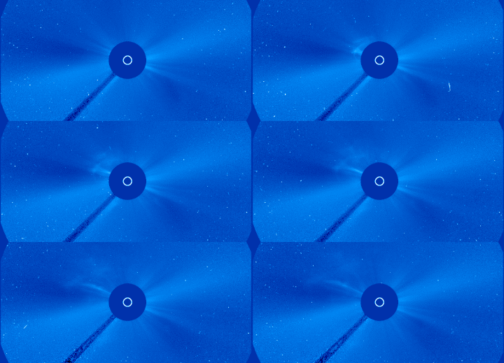
The Sun is an ordinary star, an average sized star and about half way in its life. It is our basic source of energy and it is fundamental for life on Earth. The Sun controls our climate and weather. It is our closest star, and therefore the most closely studied. From it we have learned a great deal about the physical processes which determine the structure and evolution of stars in general.
I write posts about different terms and features of the Sun, in addition to just pictures. So, you can expect picture tales and more in depth information depending on what mood I'm in and what inspires me any given time. All in all it should be possible to learn a lot about MY FAVORITE STAR.
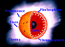
Some of the basic solar terminology that will be explained in various ways on Stellare.
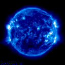

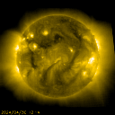
Daily Sun From SOHO
List of posts about our Sun will follow here (selected highlights).
Life cycle of the Sun
Solar cycle
Return of solar cycle 23
Sun spot - close up
Coronal Mass Ejection
Solar Prominence
Granulation and other features of the sun
Solar vocabulary - overview
The Sun - solar wind and more
Indian Space
Earth observation from space

Polar Satellite Launch Vehicle - PSLV-C9
Indian rocket PSLV-C9 successfully launched a set of new remote sensing instruments, Cartosat-2a, Indian Mini Satellite (ims-1 )and 8 Nanosatellites today.

Cartosat 2a
1 High-resolution data from CARTOSAT-2A will be invaluable in urban and rural development applications that need large scale mapping.
2 The data from the Indian Mini Satellite, another remote sensing instrument, will be made available to interested space agencies and student communities from developing countries in order to engourage capacity building in using satellite data.
3 The purpose of the eight nanosatellites is to develop nano technologies for use in satellites as well as for the development of technologies for satellite applications.
Sunday, April 27, 2008
Galactic Plane
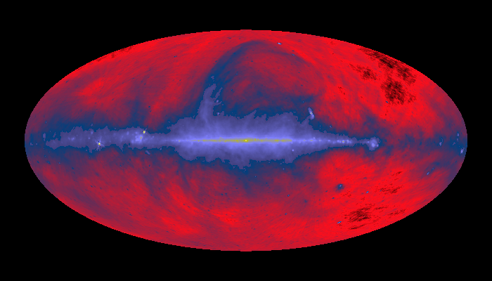
Credit: C. Haslam et al., MPIfR, SkyView
Looking at the universe in radio.

100-meter Radio Telescope Effelsberg near Bonn, Germany, Jodrell Bank, UK and Parkes, Australia are used to obtain the radio image.
Saturday, April 26, 2008
The Sun
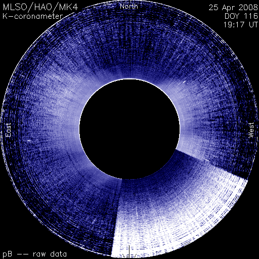
Credit: from the High Altitude Observatory Mauna Loa Solar Observatory (Hawaii)
White-light Mk. 4 coronameter images
Normally we say that the sun consist of gas. It is in fact more specifically plasma - A fourth state of matter (in addition to solid, liquid, and gas) that exists in space. In this state, atoms are positively charged and share space with free negatively charged electrons.
Friday, April 25, 2008
galileo
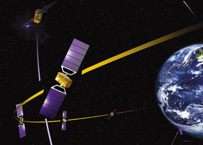
Credits: ESA- J.Huart
The second Galileo satellite will be launched from Kazakhstan this week-end.
Galileo is a Global Navigation Satellite System like GPS and GLONASS. All together these systems will improve our geodetic reference system substantially.
Galileo's new technology will revolutionize our transport systems, increasing safety and improving efficiency; this will make for better quality of life and less pollution in our cities. Galileo will also bring benefits in other aspects of everyday life, with precision farming raising yields, improved information for emergency services speeding up response times, and more reliable and accurate time signals underpinning our most vital computer and communications networks.
THE FIVE GALILEO SERVICES
OPEN ACCESS NAVIGATION
This will be 'free to air' and for use by the mass market; Simple timing and positioning down to 1m
COMMERCIAL NAVIGATION
Encrypted; High accuracy at the cm scale; Guaranteed service for which service providers will charge fees
SAFETY OF LIFE NAVIGATION
Open service; For applications where guaranteed accuracy is essential; Integrity messages will warn of errors
PUBLIC REGULATED NAVIGATION
Encrypted; Continuous availability even in time of crisis; Government agencies will be main users
SEARCH AND RESCUE
System will pick up distress beacon locations; Feasible to send feedback, confirming help is on its way

Credit: ESA - S. Corvaja 2008
The Soyuz-Fregat launch vehicle carrying GIOVE-B, the second of ESA's two Galileo In-Orbit Validation Element demonstrators for the Galileo global navigation satellite system, is erected on the pad of the launch complex at the Baikonour spaceport, Kazakhstan.
Thursday, April 24, 2008
Solar system
Tuesday, April 22, 2008
Environmental Clash

A sewerage system situated practically ON the lake? Perhaps it looks clean, but it SMELLS and God knows how much of it leaks out in the lake it is supposed to clean.
Gro Harlem Brundtland uttered the famous environmental words: Think global, act local.
Indeed, it is important to have the locals on board and as allies when implementing environmental projects. That is why it is paramount that the projects actually give the promised results - or at least some improvements. :-)
The environmental movement in China is very much aware of the need of individual engagement. One of the green organization uses the train as means of reaching the people in remote corners of China.
The same requirement of being practical and useful applies both in Norway and China and everywhere else.
This is a post in the Earth Day series.
Labels:
earth,
earth observation,
geodesy,
geoscience,
norway
Earthquakes in Norway

Stourragurra fault in Finnmark, Northern Norway
I know what I'm made of; organic material or biomass if you like. As such I cannot distinguish myself from the other biomass composing the biosphere of the Earth and therefore not the Earth itself. However, for the sake of my point I will talk about the Earth as opposed to humans and human activity and of how we can protect both Earth itself and what we as humans construct out of and on the Earth.
There is nothing we can do about earthquakes, volcanoes, tsunamis and other natural hazards on Earth. What we can do is to understand and try to predict this violent behavior of the planet, and by that protect both ourself and the planet from the consequences.
I am particularly thinking of how we can avoid building nuclear plants and the likes on top of a volcano or in a earthquake prone area. We can also calculate the expected shaking and construct our houses so that they can at least last smaller quakes.
Norway is prone with earthquakes. It is not only the fact that the country is small and remotely situation up north that might make you feel ignorant not knowing the first thing about Norway (perhaps :-)), it could also be the fact that the earthquakes are relatively small and therefore less talked about.
However small Norway is population wise with its less than 5 million people, it is a big oil, shipping and fishing nation. Norway has therefore obtained substantial information about its earthquakes. Imagine what could happen with oil and gas pipelines etc if the Earth shook them hard enough?
Understanding earthquakes and other natural hazards is therefore of out most importance also in an environmental perspective.
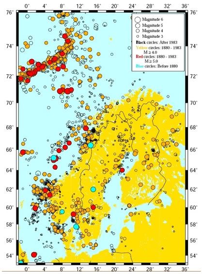
Earthquakes in and around Norway. Read more about them by clicking on the map. (NORSAR)
This is a post in the Earth Day series.
Labels:
earth,
earth observation,
eartquakes,
natural hazards,
norway
Sunquakes

Credit: SOHO
Solar flares are large explosions on the Sun's surface caused by a sudden release of magnetic energy. They are known to cause local short-lived oscillations traveling away from the explosion like water rings. It turns out that the energy in the solar acoustic spectrum is correlated with flares. This means that the flares drive global oscillations in the Sun in the same way that the entire Earth is set ringing for several weeks after a major earthquake such as the 2004 December Sumatra-Andaman one.
Solar flares are the ones feeding the solar wind that hits the Earth.
You must watch this awesome video of a sun very much alive! You simply must!
Earth Day - Part 2

Understand Protect Appreciate
Each year Earth Day marks the anniversary of the birth of the modern environmental movement in 1970.
The first Earth Day led to the creation of the United States Environmental Protection Agency and the passage of the Clean Air, Clean Water, and Endangered Species acts.
In 1990 the Earth Day became a global event and gave a huge boost to recycling efforts worldwide and also helped pave the way for the 1992 United Nations Earth Summit in Rio de Janeiro.
----------------------------------------------------------------------------------
By following the chain of posts here on SU you can learn about and enjoy various aspects of our home planet.

Earth Day reflections and Baby Green

Caring actions

Italy: Cultural Heritage and earthquakes

Surprising return of large earthquakes

Volcanoes and sharks and more...

Earth science and songs

Poetic appreciation of Earth Day

Energy politics

History: earthquake devastated the "flower power" city.

From violent earthquakes to sweet flowers and bees.

Earthquakes around the globe
Labels:
earth observation,
environment,
stumbleupon
Sunday, April 20, 2008
Moon Magnetism

Credit: Ehsan Rostamizadeh
The moon enters the Earths magnetotail three days before it is full and takes about six days to cross and exit on the other side. It is during those six days that strange things can happen like `dust storms' or electrostatic discharges...

The Moon's orbit crosses Earth's magnetotail.

Have a look at magnetospheric substorm, too!
Earth Day - Part 1
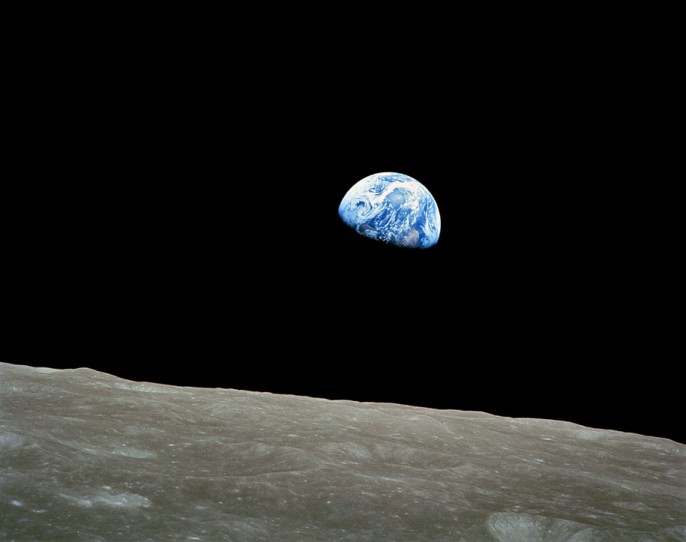
Credit: Apollo 8, NASA (1968)
Each year Earth Day marks the anniversary of the birth of the modern environmental movement in 1970.
The first Earth Day led to the creation of the United States Environmental Protection Agency and the passage of the Clean Air, Clean Water, and Endangered Species acts.
In 1990 the Earth Day became a global event and gave a huge boost to recycling efforts worldwide and also helped pave the way for the 1992 United Nations Earth Summit in Rio de Janeiro.
The better we know our planet the better we can take care of it. Scientists around the world restlessly work on improving our understanding of our home planet and here on Stellare that will be the perspective on Earth Day.
Earthquakes are one of the more dramatic behaviors of the Earth. Understanding and predicting earthquakes will save lives and have economic impacts. Earthquakes can be devastating for the environment such as fires, contamination of fresh water sources etc. Earth Day here on Stellare will cover earthquakes and other quakes...
There are however many aspects of understanding and protecting our planet. A group of SU members will demonstrate various angles of looking at what and how to protect and understand planet Earth. (That includes more earthquakes, hurricanes, cultural heritage and more)
BumApples
Comely1
Frannyy
Geojim56
IntrepidDreamer
MBMC
ShirlT
TapWaterJ
XineAnn
Yopp
will all celebrate Earth Day.
Labels:
earth observation,
environment,
stumbleupon
Friday, April 18, 2008
Earth observation - Smoke over Buenos Aires

Credit: Jeff Schmaltz, MODIS Rapid Response Team/NASA
Earth observation by satellites provide us with a powerful tool to manage our planet when facing various hazards. Buenos Aires, Argentina was covered by smoke from scrubland fires.


Labels:
argentina,
earth observation,
fire,
natural hazards,
satellites
Wednesday, April 16, 2008
Cassini, Saturn

Credit: NASA
We've learned so much about you that we want more of this...

Credits: NASA/JPL

Credit: NASA
Tuesday, April 15, 2008
Black Hole Flare

Credits: NASA/CXC/MIT/Frederick K. Baganoff et al.
Sagittarius A-star (A*), is a certified monster, containing about 4 million times the mass of our Sun. It is our galaxy's central monster black hole and as it turns out, it let loose a powerful flare three centuries ago. We know this because of Newton; not Isac Newton, but the space telescope XMM-Newton from ESA and a couple of X-ray instruments from NASA (US) and JAXA (Japan).
Subscribe to:
Comments (Atom)
