Friday, July 31, 2009

Supernova


Sharp Supernova


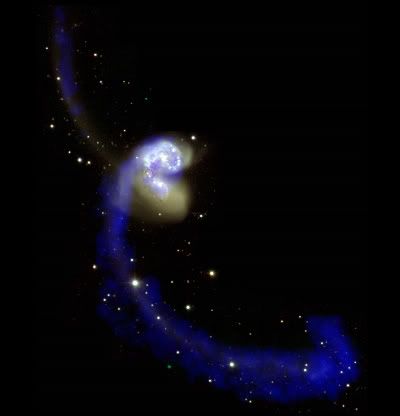
Credit: X-ray: NASA/CXC/Rutgers/G.Cassam-Chenaï, J.Hughes et al.; Radio: NRAO/AUI/NSF/GBT/VLA/Dyer, Maddalena & Cornwell; Optical: Middlebury College/F.Winkler, NOAO/AURA/NSF/CTIO Schmidt & DSS

One of my favorite supernova remnants looking sharp thanks to Chandra. :-)


Thursday, July 30, 2009

Health from Space


Health & Space


A risk-assessment map shows the areas of increased risk of Rift Valley Fever (RVF) in eastern Africa from fall 2006 to spring 2007. Pink areas depict increased risk of disease, while pale green areas reflect normal risk. Yellow dots represent reported RVF cases in high-risk areas, while blue dots represent occurrences in non-risk areas. Credit: Assaf Anyamba and the NASA Earth Observatory


A satellite-derived vegetation map, known as a Normalized Difference Vegetation Index, shows the amount of plant growth above (green) and below (brown) the norm for East Africa. Credit: Assaf Anyamba and the NASA Earth Observatory


Most people don't realize to what a degree space based Earth observation saves lives!

I am downright provoked by those who claim they don't want to work with technology because THEY WOULD RATHER SAVE LIVES WORKING WITH HUMANS. You see it all the time, the ads showing starving children appealing to your generosity and will to save lives. Celebrities visiting poor countries or refugee camps encouraging you to give money to FOOD AND MEDICINE. Never technology, never satellites. Well, they should, because that is how you help MORE PEOPLE in one go.

Earth observation from space is a really, really powerful tool for not only saving lives but improving our health as well. This example from Africa shows how combining environmental data gathered by satellites such as sea surface temperature and vegetation growth with in-situ observation results in risk assessment maps that together with forecasts of rain can be used to mitigate the outbreak of diseases carried by mosquito.

It upsets me that this human aid from space is overlooked and underestimated.

Space is good for your health! :-)


Wednesday, July 29, 2009

Stars - Betelguese


Betelgeuse, Betelgeuse!


Credit: Eso

You Are Pretty!


But, I'm afraid most people will disagree when scientist say that you look sharp, in spite the fact that this the sharpest image yet taken of you. :-)


Tuesday, July 28, 2009

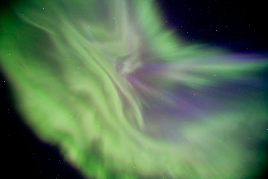
Aurora Borealis


Aurora Borealis


Because it was about time! :-)


Saturday, July 25, 2009

Grand Canyons


Grand Canyon from above


Credit: ESA


This is an excellent example of satellite art of a place that is a natural wonder in-situ, as we professional earth observers say when distinguishing between observations made from space and observations made on Earth itself. :-)

Dive into the the big version.

I have not yet had the pleasure of visiting Grand Canyon (in-situ), but I have visited the grand canyon of Texas; Palo Duro Canyon up in the Panhandle, on several occasions. It is spectacular and they have an outdoors show that makes you travel back in time and get a deeper understanding of the famous Texas hospitality. I just watched the shows website and they actually have a 'hospitality specialist' hired. If I had not had been there I would not understand why and what that is, but let me assure you, Texans know how to make you feel welcome!

And even the CEO's wear their cowboy hats!

I love Texas! :-)


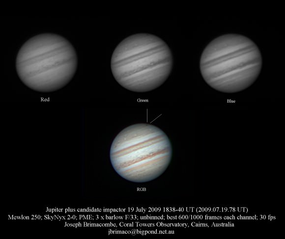
Jupiter Impact


Strike Jupiter


...and make another spot! :-)


Friday, July 24, 2009

Solar Eclipse - 2009


Solar Eclipse in Asia


Credit: NASA

Longest duration this century. Wish I could have been there...


Wednesday, July 22, 2009

Apollo 11 launch pad


Apollo 11 Launch Pad


Credit: NASA

Looks nice from the sky...:-)


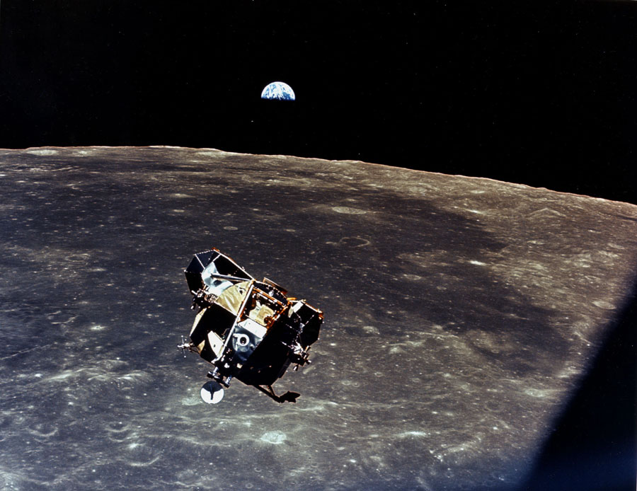
On The Moon


On The Moon!


Credit: NASA

Apollo 11 landed 40 years ago - on the Moon.


Uncertainties


Uncertainties!


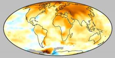
That climate models are inaccurate and uncertain are obvious to me - so this is no shocker. It does not mean that we can say what the heck - no problem. On the contrary. The uncertainty does however make it difficult to adapt to global changes. The topic of my July episode of A Green Space - A Green Earth is the uncertainty related to sea level rise.

We need better models AND more data to fully understand or at least better so that we can make adequate plans.

I had a delightful lunch with a climatologist in Oslo today - she has set her mind on helping city planners and policy makers through visualizing climate data on maps - for their location in Norway. For some places it is clear that measures must be taken already today - like for New Orleans in USA and The Netherlands already lying below sea level. In Norway we are definitely worried about Bergen...


Monday, July 20, 2009

Solar Eclipse - 2009


Solar Eclipse coming up


I 'almost' went to China to experience this solar eclipse. Now I'm working in Rome instead...:-)


Monday, July 13, 2009

InSAR in Wenchuan - China


Funky 'Seismic' Pattern


Credits: Jianbao Sun, IGCEA, Seismology and Geology, No.3, 2008

Wenschuan, China, May 2008


InSAR is the hottest tool to use from space - look how totally hippie the Wenchuan earthquake looks like using interferometry.

Using InSAR and GPS data, scientists are able to measure and monitor where and how stress changes in the crust as well as how any associated deformation is distributed.

We are definitely going to see more of these kind of maps! :-)

And oh, yeah. I dedicated an episode of A Green Space - A Green Earth to natural hazards. There you can see equivalent maps of L'Aquila after the earthquake this April. It has absolutely nothing to do with G8 in case you wonder...:-)


Sunday, July 12, 2009

The Aral Sea - A Pulsating Smaragd


Pulsating Smaragd


Credit: ESA

The Aral Sea 2006 - 2009


Gundam


Gundam


Credit: Zhang Jingna


Awesome anime character in extra-mega size in Tokyo. I miss Tokyo, one of my favorite cities on this planet! :-)


Volcano


Manam Volcano


Credit: NASA

Picture Perfect! :-)


Thursday, July 9, 2009

Space A La China


Space A La China


This is an excellent illustration that space can be experienced in very different ways depending on your cultural standpoint. I can't express how much I love the perspective of space exploration inherit in this happy illustration. So fundamentally different than our streamlined Western approach. :-)

Happiness and friendship in space!

Thrown my way by Andrzej

Wednesday, July 8, 2009

Mars - Here We Come Again


Together to Mars


Credits: NASA, J. Bell (Cornell U.) and M. Wolff (SSI)


ESA and NASA join forces to explore Mars. Awesome! :-)


Thursday, July 2, 2009

Climate Change and Sea Level - I


Climate Change and Sea Level Rise


The Mississippi delta as it would look like if land continues sinking and sea level rises one meter.
A new model predicts that 10 percent of Louisiana will be submerged by the year 2100.M.

Credit: Blum and H. Robert


There are several factors contributing to changing sea level. Today, we have not yet understood the dynamic Earth well enough to predict sea level. The uncertainties are too large for politicians and coastal managers to handle. This is the topic of my July edition of A Green Space - A Green Earth. .


Wednesday, July 1, 2009

Topographic World Maps


Topography


Japan and USA have worked out a nice and comprehensive world map of our planet. Nifty! :-)