skip to main |
skip to sidebar
Mapping the Moon
Apollo 17 Landing Area
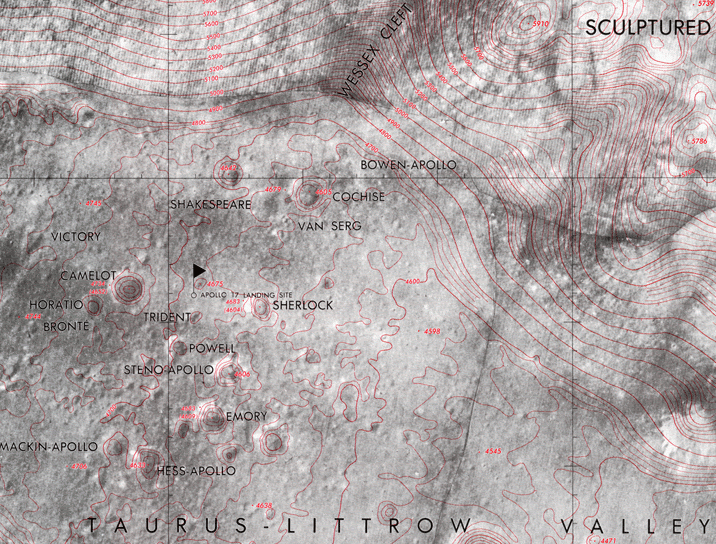
Lunar Topographic Orthophoto, Arizona's Lunar and Planetary Laboratory
Through the use of telescopes, then photography, lunar mapping improved through time; it found ultimate expression in the 1961 Orthographic Atalas of the Moon, bu the University of Arizona's Lunar and Planetary Laboratory. The next phase of lunar mapping was motivated by the Soviet-American race to the moon. Each country wanted better maps for proposed landing sites; this led each to photograph the moon from unmanned spacecraft. The last three Apollo moon missions in 1972 and 1973 carried cameras designed by aerial photographer-cartographer Frederick Doyle, who diercted Apollo's Orbital Sceince Photo Team, a joint NASA-U.S.Geological Survey effort. More than 30 percent of the moon's surface was photographed in detail. The Apollo images were overprinted with contours at 100-meters vertical intervals and spot elevations.
Ralph E. Ehrenberg, former chief of Geography and Map Division of the Library of Congress


No comments:
Post a Comment