Credit: NASA/JPL/Space Science Institute
Saturday, February 28, 2009
Flight Physics
Credit:Arnold Air Force Base
Pressure-sensitive paint can tell engineers what parts of a plane or shuttle are getting buffeted the most.
The Paint Says It All.
Friday, February 27, 2009
Herschel Ready to Go
The European Ariane rocket is ready to shoot this blue baby up in the sky from Kourou, French Guyana.
One fat mirror to go. In fact the biggest mirror of all times is sent out of our atmosphere to take a better look at the rest of the universe.
Thursday, February 26, 2009
Far Side of The Moon
Credit: JAXA
Gravity
Credit: JAXA
Topography
Figures: The topography maps and free-air gravity maps of the global Moon obtained by JAXA's KAGUYA spacecraft. The far-side is on the left and the near-side is on the right.
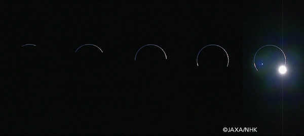
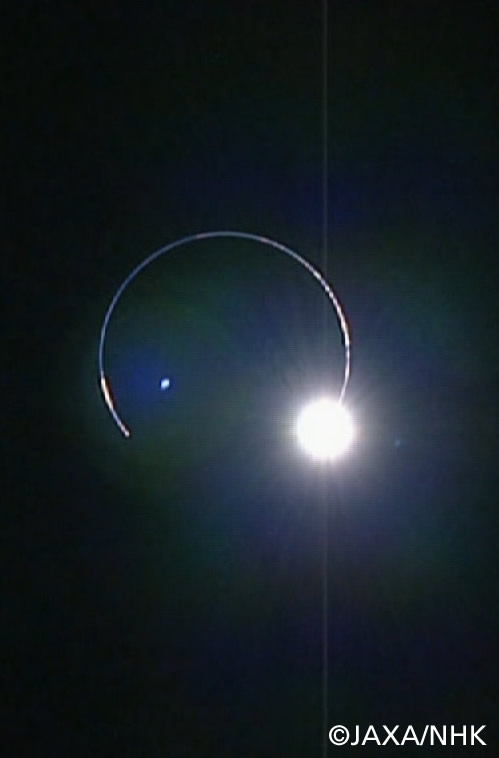
An Eclipse of The Earth
That Even Comes with A Diamond!
Here is a schematic description of an Earth eclipse as seen from the Moon:
You go directly to the JAXA source by clicking on the images (as usual) and here is a couple of other perspectives on the event:
Nancy Atkinson's in Universe Today: Kaguya captures eclipse - from the Moon
Phil Plait's in Bad Astronomy: What does a lunar eclipse look like from the Moon
Wednesday, February 25, 2009
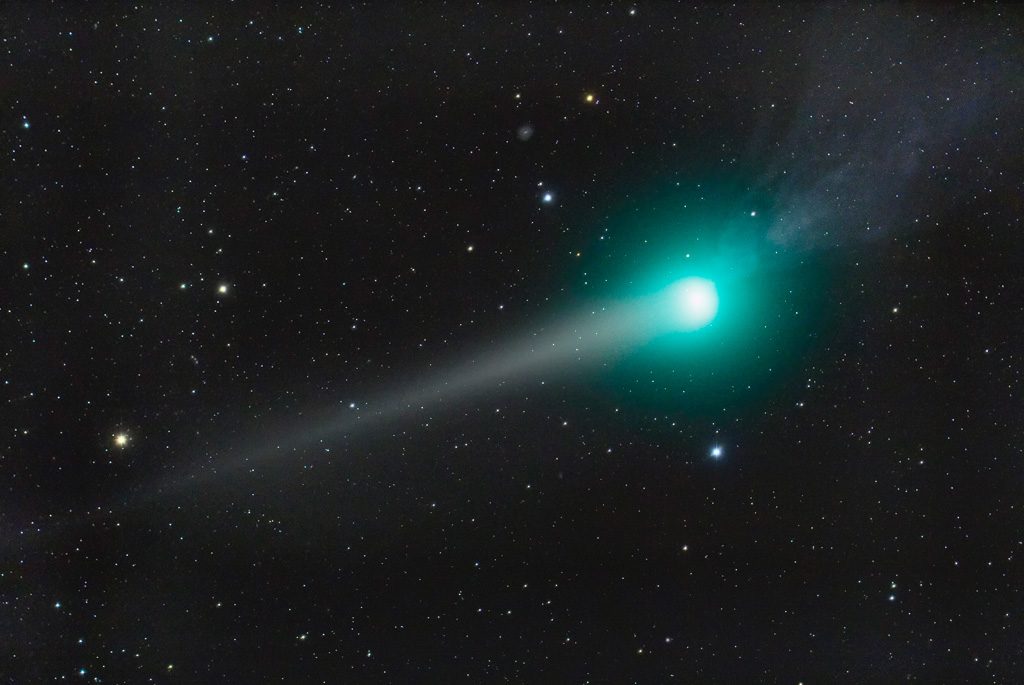
Lulin
Credit: Richard Richins
Ok, so I post another image of the lovely Lulin. It is so nice and bluish (I ignore the green tones...). I picked another image of the comet earlier on, when it was smaller. It should be on it's most magnificent seen from Earth right now.
Virtual Space
Tuesday, February 24, 2009
Carbon Observations from The Sky
Ready to launch today. Good luck, NASA!
And Action: Feb. 24 at 1:51:30 a.m. PST (4:51:30 a.m. EST).
Blog of OCO Action
Monday, February 23, 2009
Saving WIldlife in China after The Quake
Sunday, February 22, 2009
King Fisher
Photo: Romy Ocon
I've been fascinated by these birds since I was a little girl. Look how determined they appear! Just like me. :-)
Saturday, February 21, 2009
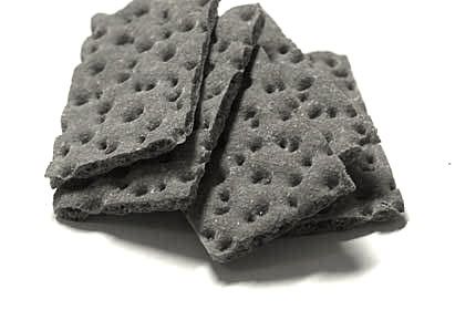
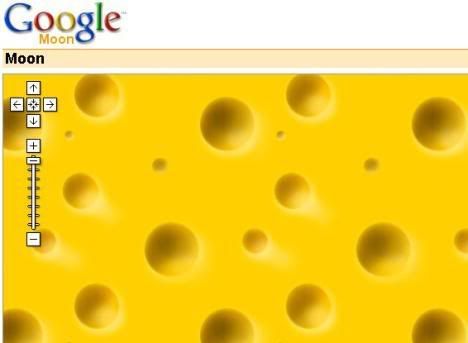
The Moon Is Jarlsberg, Mars Is Wasa
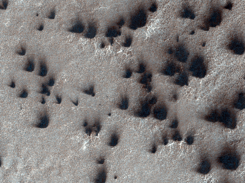
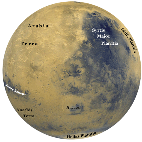
Well, I bring you the evidence, people of the internets. It is pretty obvious. You don't need to be a rocket scientist - even though technically speaking I am - to understand that this is Wasa up there on Mars. THAT is News.
Credit: NASA/JPL/University of Arizona
Fans of ice is the official title of this image, ignoring the fact that this is clearly a piece of Wasa crispbread.
Credit: Ola Sæther/BLB
It can only mean two things. Either the Swedes have a space program beyond our wildest dreams and resides on Mars since, well since the medieval Wasa era, and forgot to hide their crispbread before NASA sent all sorts of imagery instruments up there. Or, Mars IS actually made out of Wasa crispbread, just like the Moon is made out of Jarlsberg cheese. You tell me which theory you prefer! :-)
This is how Google presented the Moon at an early stage of Google Moon....
Go HiRISE!!
Silk Fibre Formation
Silk is an interesting material, not just because of its beauty, but for scientific reasons as well. Ah, the things we can do with fancy x-rays! :-)
Orbit The Earth
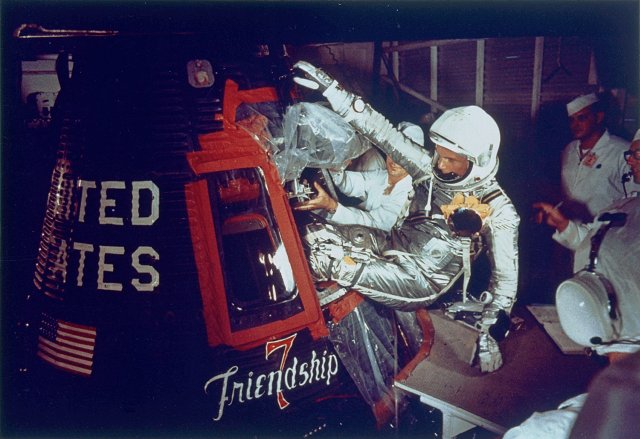
Credit: NASA
On Feb. 20, 1962 at 9:47 am EST, John Glenn launched from Cape Canaveral's Launch Complex 14 to become the first American to orbit the Earth. In this image, Glenn enters his Friendship 7 capsule with assistance from technicians to begin his historic flight.
My hero Yuri Gagarin was the first human to orbit the Earth. I certainly admire the first American who orbited the Earth, John Glenn, too.
Friday, February 20, 2009
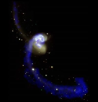
Hot Merging Galaxies
Please, DO play the movie. It is fabulous!
Found via the hot news channel Astrocast.TV blog.
Thursday, February 19, 2009
The Outer Planets
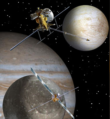
Credits: NASA/ESA
We Need to Check out The Outer Planets.
ESA and NASA have decided to put their money on the outer planets and their moons. Jupiter and Saturn, here we come, again! :-)
Wednesday, February 18, 2009
Hubble and Space Debris
We Are Worried Sick. Look at The Debris!
Read all about the details of the collision causing all the Hubble danger here!
Tuesday, February 17, 2009
Galileo Galaxy
Credit: NASA, ESA, CXC, SSC, and STScI
This golden spiral galaxy is named Messier 101 and is the visible light version of a series of images taken at different wavelenghts.
In honoring the 400th anniversary of Galileo Galilei, practically the first to use a telescope, the Hubble telescope and many others, release special images for us to enjoy.
Monday, February 16, 2009
Galileo on Environment
Credits: ESA- J.Huart
Galileo - Europe's Global Navigation Satellite System
It is not that I dislike green, but rather that I LOVE blue and I get so sick and tired of everything called green. Why not blue? After all a clean and healthy OCEAN is environmental even more than the green you find on the continents covering merely 30 % of this planet's surface anyways. I'm just saying....before I give you GreenDrive. :-) Call it BlueDrive and I'll buy several for my car!
GreenDrive advises the driver on the most economical driving style to use, when to accelerate, when to break, and when to keep the speed. This is done on mobile phones and personal navigation devices.
Sunday, February 15, 2009
Ariane's First in 2009
Credit: : ESA / CNES / Arianespace / Service Optique Video du CSG - P. Baudon
From French Guinea Ariane took a couple of telecommunication satellites to geostationary orbit. Looks fabulous even from here. :-)
Saturday, February 14, 2009
Moon & Circle
Friday, February 13, 2009
Environment & Humans
I grew up on the countryside and here we live in houses that are spread out all over the place. Nothing like the villages you find down in Europe for instance, where all the houses are thrown together. I need this space and it became evident for me at a very early age. I remember driving from our home to Oslo as a kid, noticing that when we approached the capital the housing changed and we saw these housing complexes with several stores high buildings. My first meeting with condo's. It was a depressing shock to me, I asked myself how could anybody possibly live under such degrading conditions. I swear, I got really depressed.
As I am no longer a kid I can see that it is possible to live like that, but what Sandy's article says is that it is important to create green lounges and otherwise make room for plants and greenery and not fill it all with concrete. Pure concrete makes us miserable. Simple as that. :-)
Thursday, February 12, 2009
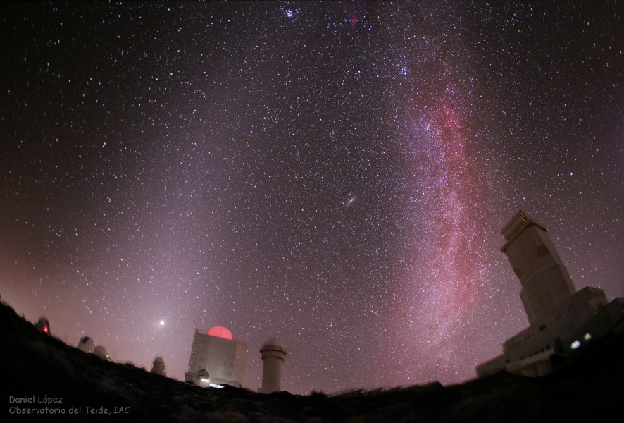
Telescopes in Pink
Credit: Daniel López, IAC
Labels:
astronomy,
milky way,
photography,
telescopes
Jason & Jason
Right now we have a tandem situation. Jason-1 and Jason-2 are flying in tandem above our heads. Sounds like fun perhaps, but who cares? And who are Jason and what's with the numbers, anyways?
Credit: NASA A "family portrait" of Jason-1, Topex/Poseidon, and Jason-2 for 28-Jan-09 at 23:39 UTC,
showing the position of all three satellites as they descend to the southeast, passing over ground station just outside of Toulouse, France.
Obviously we are talking about two distinct Jason's; Jason-1 and Jason-2. They are both satellites orbiting planet Earth carrying altimetry instruments. An altimeter measures the distance from the satellite, where the altimeter is placed, to the surface of the Earth. So the Jason-1 and Jason-2 satellite altimeters measure sea surface height. As you might guess, these satellites are useful tools monitoring changes in sea level, but there are other useful data coming out of these instruments as well.
The sea surface is not at all as smooth and even as we imagine. The oceans are all bumpy and change their bumpiness continuously. By scanning the sea surface height over large areas of the ocean over and over again we get both the real topography (bumpiness) of the oceans as well as their variations. Some of the features of the ocean surface reflect the topography of the ocean bottom, the vast unknown of this planet. Other features are results of climate change and other effects caused by the dynamic processes of the rotating Earth.
Coming back to the tandem satellites Jason-1 and Jason-2 now. It is imperative that we have overlaps between these satellites in order to calibrate the collected data. If we do this right we will have much better and longer time series of for instance the changes of sea surface height and thereby the sea level rise. In the process of this calibration we also gain a much better resolution of the data and hence can see features such as smaller currents and eddies of the oceans that are lost with less spatial resolutions. The tandem simply gives us a sharper eye in the sky.
The Jason's are among the space geodetic tools we rely on to determine the shape of the Earth and its' continuous changes.
The adventure really started with the Topex-Poseidon satellite (you see it mentioned in the first illustration here between the two Jasons') As I said, it is imperative for long time series that we have satellite altimetry instruments continuously measuring the sea surface heights. The international science community has pulled together, struggling to convince the funding agencies that we cannot afford holes in the time series. It was a close call but we are already in the tandem phase now!
It is worth mentioning that this is a successful cooperation between Europe and the US in particular. The major organizations contributing to this mission are EUMETSAT and CNES in Europe and NASA and NOAA in the US, but there are numerous other contributors as well.
showing the position of all three satellites as they descend to the southeast, passing over ground station just outside of Toulouse, France.
Obviously we are talking about two distinct Jason's; Jason-1 and Jason-2. They are both satellites orbiting planet Earth carrying altimetry instruments. An altimeter measures the distance from the satellite, where the altimeter is placed, to the surface of the Earth. So the Jason-1 and Jason-2 satellite altimeters measure sea surface height. As you might guess, these satellites are useful tools monitoring changes in sea level, but there are other useful data coming out of these instruments as well.
The sea surface is not at all as smooth and even as we imagine. The oceans are all bumpy and change their bumpiness continuously. By scanning the sea surface height over large areas of the ocean over and over again we get both the real topography (bumpiness) of the oceans as well as their variations. Some of the features of the ocean surface reflect the topography of the ocean bottom, the vast unknown of this planet. Other features are results of climate change and other effects caused by the dynamic processes of the rotating Earth.
Credit: NASA/Jet Propulsion Laboratory
Jason-2 map of sea-level anomalies from July 4 to July 14, 2008.
Coming back to the tandem satellites Jason-1 and Jason-2 now. It is imperative that we have overlaps between these satellites in order to calibrate the collected data. If we do this right we will have much better and longer time series of for instance the changes of sea surface height and thereby the sea level rise. In the process of this calibration we also gain a much better resolution of the data and hence can see features such as smaller currents and eddies of the oceans that are lost with less spatial resolutions. The tandem simply gives us a sharper eye in the sky.
The Jason's are among the space geodetic tools we rely on to determine the shape of the Earth and its' continuous changes.
The adventure really started with the Topex-Poseidon satellite (you see it mentioned in the first illustration here between the two Jasons') As I said, it is imperative for long time series that we have satellite altimetry instruments continuously measuring the sea surface heights. The international science community has pulled together, struggling to convince the funding agencies that we cannot afford holes in the time series. It was a close call but we are already in the tandem phase now!
It is worth mentioning that this is a successful cooperation between Europe and the US in particular. The major organizations contributing to this mission are EUMETSAT and CNES in Europe and NASA and NOAA in the US, but there are numerous other contributors as well.
Wednesday, February 11, 2009
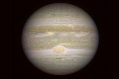
Jupiter
Credit: NASA/JPL/University of Arizona
The HiRise camera normally takes awesome images of Mars. Thanks to the need for calibration HiRise directed it's 'lenses' towards Jupiter and the original image was blurred (and HiRise got what it needed) but the Earth was good enough for sharpening the images afterwards. Since HiRise is closer to Jupiter than we are the quality of the image ended up being on the same level as Hubble.
Tuesday, February 10, 2009
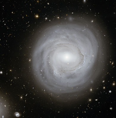
Hubble Galaxy
Credits: NASA, ESA and K. Cook (Lawrence Livermore National Laboratory, USA)
Stoat in Snow
Mustela erminea Linnaeus 1758
This is exactly how happy I am for all the delicious white snow we have right outside the door...:-)
It's skiing time! Yay!
Monday, February 9, 2009
Jovian Planets
Illustration by Jonathan DuBois
Sunday, February 8, 2009
Astronomy News
Roving around on Mars for 5 years!, NASA's celebration of the Mars missions, is included in Episode 11 of Astrocast.TV.
This month they have of course included some space celebrating NASAs 5 years on Mars. (go to appx 5:10 min).
On their blog you can go deeper into the material if you like and find links to more stuff. I hope they'll include even more material on their blogs in the future.
If you prefer the YouTube interface the programs are available there too.
I learned that CNN has stopped their dedicated science and space programs. Too bad they don't see how they can use the new media then. Astrocast.TV is an example of what exciting times we live in media wise. Anybody can make their own TV station now! :-)
Subscribe to:
Posts (Atom)