Showing posts with label ice. Show all posts

Friday, March 4, 2011

Tasmanian Iceberg Congregation


Tasmanian Iceberg Congregation


Credit: Nasa

The New Zealand earthquake shook off a 30 million ton chunk of a Tasmanian glacier creating a number of icebergs.


Thursday, September 23, 2010

Mass Movements


Mass Movements


No, it is not activism or political mass movements we talk about, but the mass that is displaced continuously here on planet Earth. We track it down by using satellites.


Tuesday, May 5, 2009

Mapping Icy Topography


Icy Topography


Using Synthetic Aperture Radar to map the icy topography in the Arctic.

A good radar is worth it's weight in gold. I don't know, but it sure is very useful - and way cool to fly over those vast areas of Greenland and Iceland with nothing but ice. I know there are not much of a toilet onboard those planes so I hope they are careful with the eating and drinking....:-)


Saturday, April 4, 2009

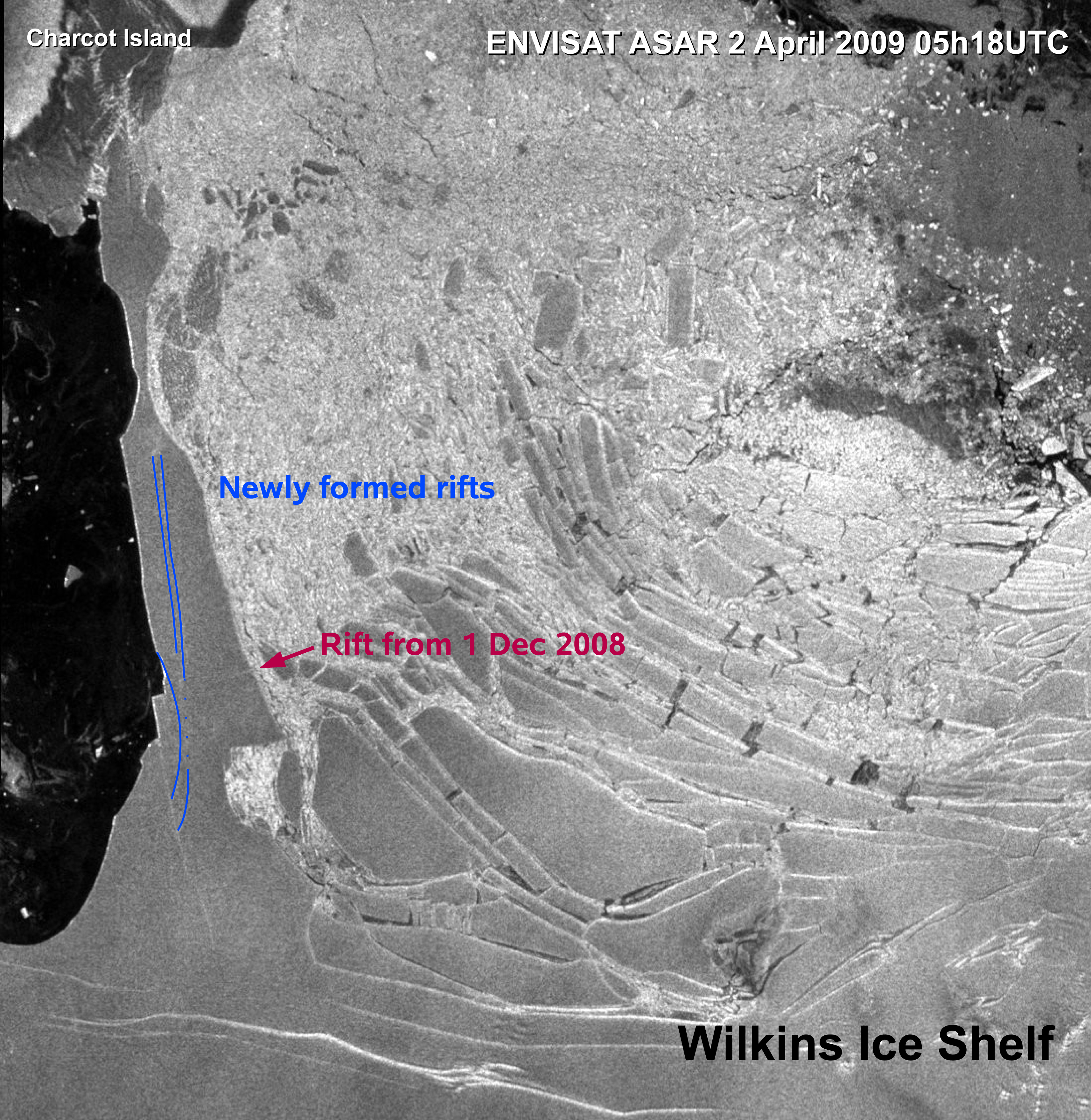
Earth Observation in Antactica


Breaking The Ice in Antarctica


Credit: ESA (Annotations by A. Humbert, Münster University)
Click on the image for a larger view of the rift in the ice bridge supporting Wilkins Ice Shelf in Antarctica.


Credits: ESA

This map is showing break-up events of Larsen-B and Wilkins ice shelves, as observed by Envisat, in Antarctica.


Earth observation from space is a powerful tool when we try to understand what happens to our planet. I'm so fond of the concept of getting accurate data that will improve our Earth models. The more the merrier - the better will our predictions be. A real money saver, if you ask me. :-)


Sunday, July 13, 2008

Great Wall of China

Great Wall of China in Ice


This is an ice model of the Great Wall of China. Photo by R Todd King taken at Harbin Snow and Ice festival 2003. Check the link for more amazing pictures. Also the post above for the festival 2007.

Geodesy on the Wall 2007

I will not miss this beautiful opportunity to inform you that geodesy is being applied on the Great Wall of China. China is now re-measuring the length of the wall by using modern geodetic techniques. We expect the result to be ready before the 2008 Beijing Olympic Games.


This is me on the Wall surrounded by Chinese who thought I was some kind of star....


This is at another more peaceful spot on the Wall where we test a gravimeter that actually bears the same name as Mt. Everest - Qomolangma. Qomolangma is the Tibetan name of the worlds highest mountain. This instrument had not only the name of the mountain, it had been there on several occasions as well.

Tuesday, April 29, 2008

Earth Observation Ice


Splitting Iceberg


Satellite image taken by Advanced Synthetic Aperture Radar (ASAR) on Envisat - a European Earth Observation Satellite. The berg - in the right of the picture - is located to the east of South Georgia in the southern Atlantic Ocean. ASAR can see through clouds, and can distinguish different types of ice.

I never stop being amazed by the power of modern technology. I have always thought that space observations are first and foremost useful, like in this case, but I appreciate that it can be used for destructive purposes also.